Dear brothers,
We would like to give you a brief update on the fire burning near our conference center in Oak Glen. The property is now included in the mandatory evacuation zone and all of the saints living on the property have moved off the mountain. Initially the wind caused the fire to burn away from the conference center, but changing winds throughout the past two days have caused the fire to progress slowly towards our property. We ask that the churches would pray for the Lord to protect His interest at the conference center and that the fire would be kept away and be brought under control by the fire crews.
In Christ,
The brothers serving for the Southern California Blending Center
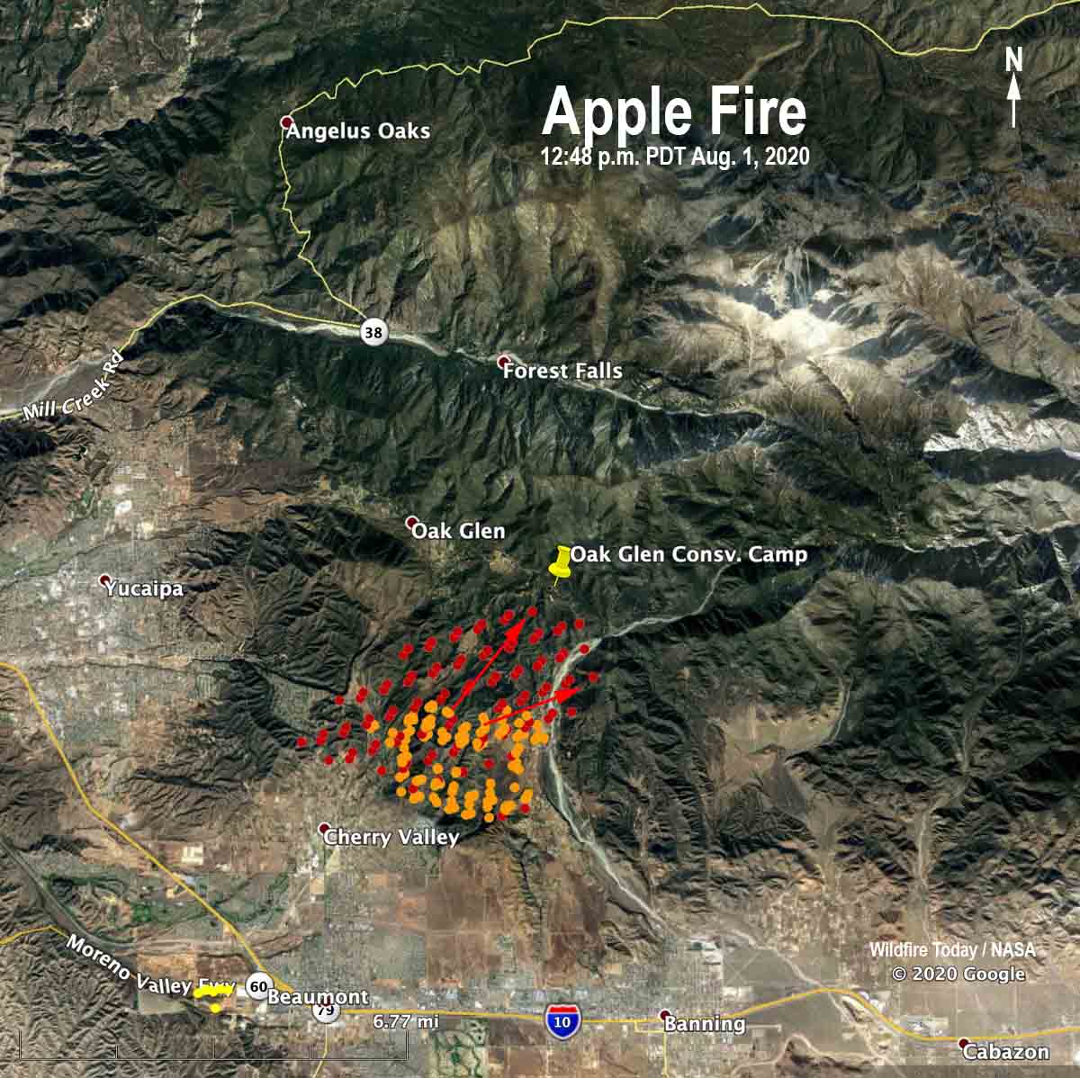
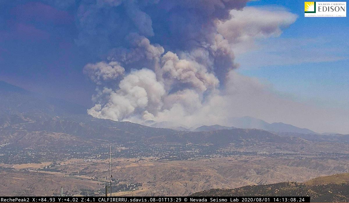
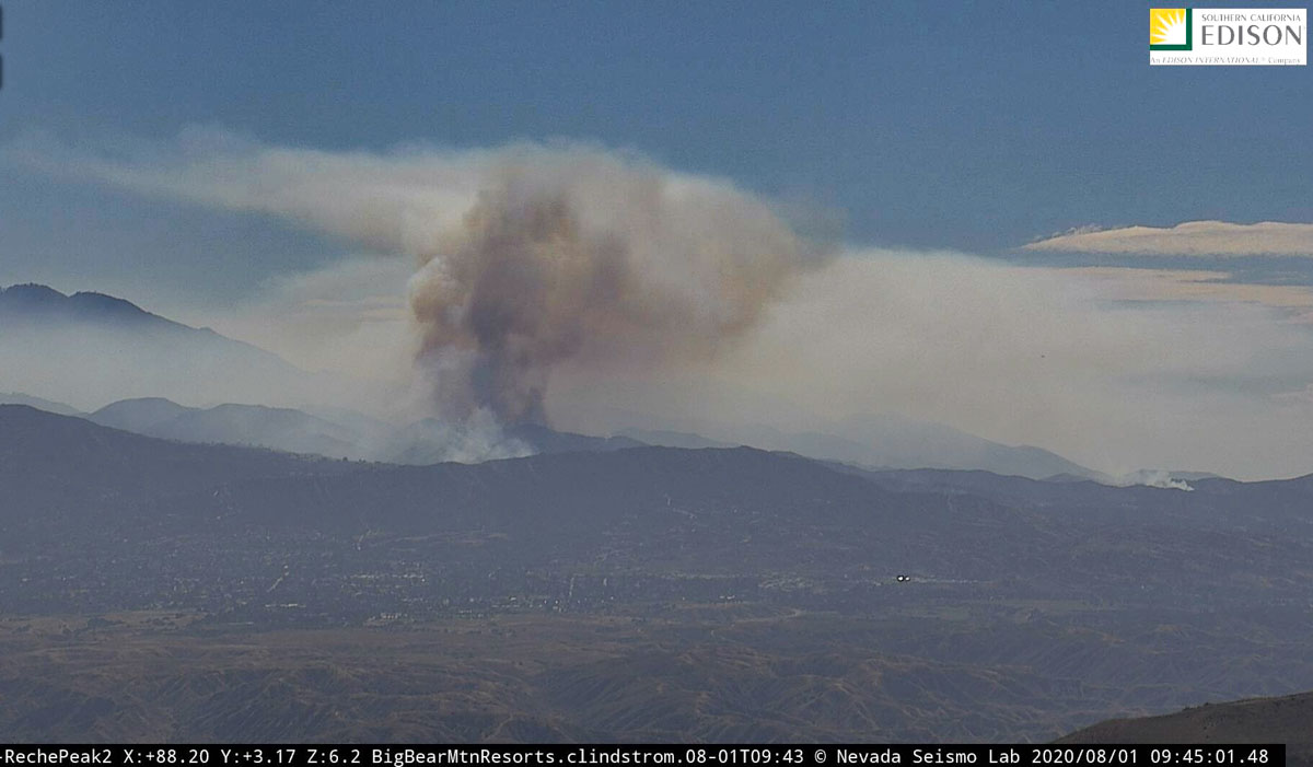
The map below shows heat detected on the Apple Fire by a satellite at 12:48 p.m. PDT August 1. On Saturday the fire has been moving to the north and east and by 3:30 p.m. had spread past the Oak Glen Conservation Camp.
(To see all articles on Wildfire Today about the Apple Fire, including the most recent, click here.)
UPDATED at 3:31 p.m. PDT August 1, 2020
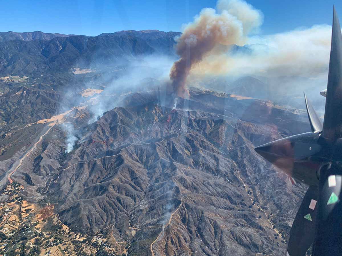
The Apple fire has been very active in the early afternoon Saturday, spreading up the slope at least two miles over the last 12 hours, surrounding CAL FIRE’s Oak Glen Conservation Camp #35. The 40 acre site built in 1949 for housing and training up to seven inmate fire crews is the largest state facility of its kind.
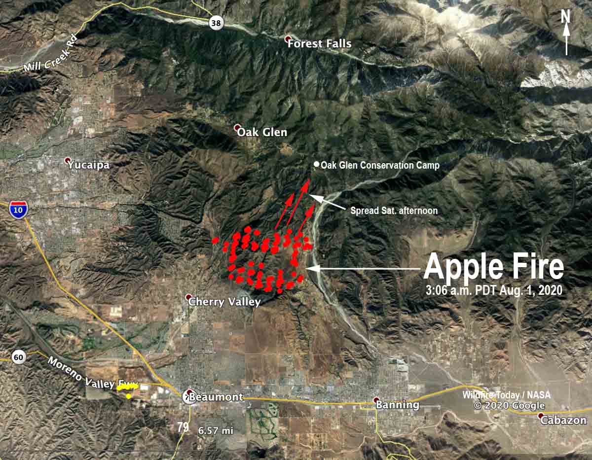
CAL FIRE/Riverside County reported at 3 p.m. Saturday the Apple Fire has burned 4,125 acres.
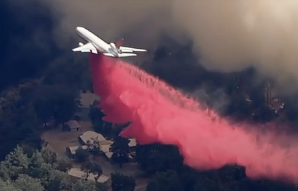
Firefighters have ordered additional large and very large air tankers including two DC-10s and the 747. Additional strike teams of engines, dozers, and crews have also been requested.
The weather conditions are not in favor of the firefighters. At 2:13 p.m. Saturday a weather station at Banning recorded winds out of the west at 10 mph gusting to 22, temperature of 99 degrees, and relative humidity of 9 percent.
(Originally published at 10:32 p.m. PDT August 1, 2020)

At about 5 p.m. Friday when firefighters arrived at what is now the Apple Fire north of Beaumont, California in Cherry Valley, they found at least two separate fires burning along Oak Glen Road. Saturday it has grown into a 1,900-acre blaze that has prompted evacuations and has destroyed at least one home and two outbuildings.
CAL FIRE/Riverside County Fire is in Unified Command with the U.S. Forest Service, Riverside County Sheriff’s Department, and California Highway Patrol.
The fire is burning between Oak Glen Road on the west and Bluff Street on the east. It is about three miles south of Oak Glen.
Resources working on the fire Saturday morning include 5 helicopters, 43 fire engines, 10 hand crews, 3 water tenders, and 3 dozers, for a total of 375 personnel. Large and very large air tankers are busy over the fire this morning.


